
Mountsorrel & Rothley Marshes
Location
OS Map Reference
SK 590140 (Sheet 246)View on What3Words

Know before you go
Dogs
When to visit
Opening times
Always openBest time to visit
WinterAbout the reserve
|
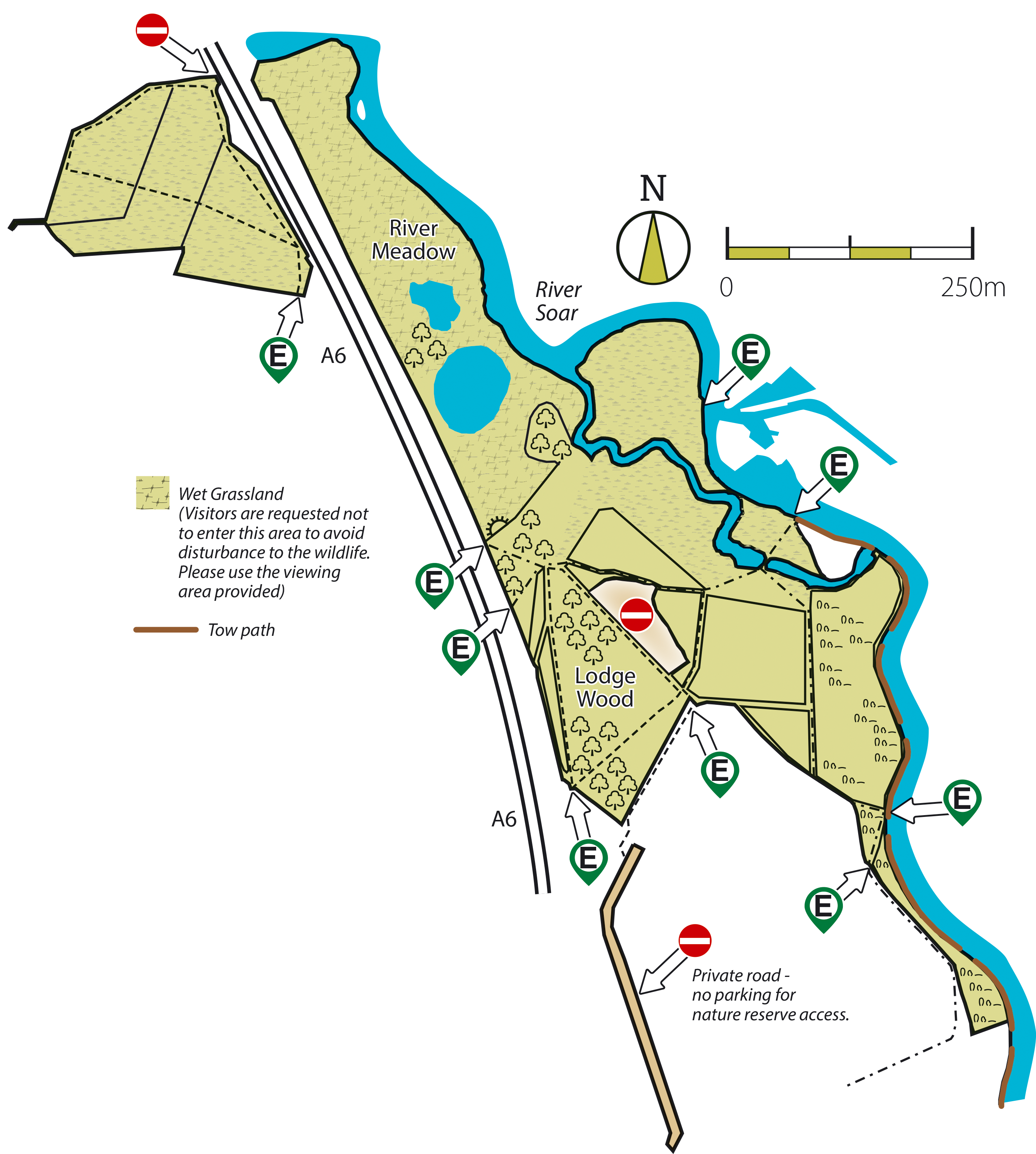
This exciting and innovative reserve is part of the Soar Valley floodplain system. Originally agricultural fields, harvested for maize, grazed by cattle and used as grassland in their recent history, we are now allowing nature to take back control. This is perfect for both people and wildlife, as we hope that this floodplain reserve will help to protect the homes and livelihoods in the area, by soaking up rainwater in times of flooding. This also creates ideal conditions for plants and animals to thrive. A network of scrapes, pools, meadows and naturally-regenerating woodland, we are working with nature to bring real diversity to this reserve. The wet grassland and shallow wet scrapes have been designed to encourage overwintering birds such as lapwing, snipe and redshank. All year-round visitors are likely to include grey heron, mallard and skylark. As the wet woodland grows it may encourage various warblers to visit and hopefully breed. The main woodland area was planted with alder trees and willow sticks. Smaller areas of woodland have developed entirely on their own from seeds which have blown in or washed in by floodwaters. We are hopeful to see a diversity of wildflowers and plants, too. Typical species expected to arrive naturally are purple loosestrife, ragged-robin, cuckooflower and many species of rush and sedge. As a new reserve, this area will be constantly changing, benefiting from the nearby wild places that we also manage. It is part of a larger area of managed floodplain within the Soar Valley including the nearby Trust reserves of Cossington Meadows and Wanlip Meadows. As such, it is always worth a visit to see what else might have turned up. Please use the viewing platform to observe the wildlife in the meadows and scrapes. This has been designed to enable people to view the reserve without causing disturbance to the wildlife. Visitors are asked not to enter the main meadow area. |
Contact us
Reserve Map

Download Mountsorrel & Rothley Marshes Nature Reserve Map
- Mountsorrel & Rothley Marshes Map (2.64 MB)


